#
FieldLogix releases its driver-centric dash camera policy guide

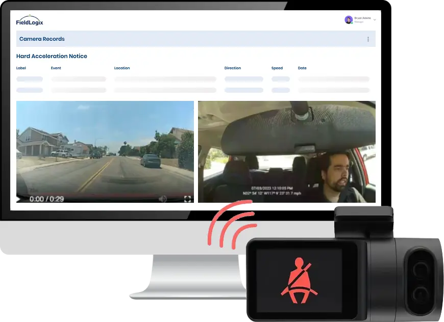
FieldLogix announces the release of its guide for creating a company policy for dash cameras.   The guide discusses all of the factors involved when creating a dash camera policy and how to make the policy driver-friendly in order to minimize driver resistance. “In todays’ litigious world, fleets are often targeted by unscrupulous motorists for insurance […]

Reduce Fuel Costs with FieldLogix Fleet Tracking System

With FieldLogix, fleet management is no longer left in the dark wondering where their drivers are or what they are doing. A real-time fleet tracking system can empower you to better optimize, manage and capitalize from your fleet’s activities. Different fleets have different reasons for using FieldLogix: fuel costs are reduced, drivers are more safe and also held more accountable, improved customer service, lower maintenance costs, tax reporting needs, increased fleet productivity.

University Students Forced to Wear GPS Tracking Devices

Tri-Valley University was recently shut down by the US Immigration and Customs Enforcement (ICE) due to alleged fraud by the University Founder, Susan Su. Tri-Valley University is being called a sham by federal prosecutors who say the university was a front to illegally provide immigration status to foreign nationals. Over 90% of Tri-Valley University students […]

Gas Prices Expected to Rise in 2011 Due to Egypt Turmoil

Gas prices have steadily been rising since December. Gas prices are expected to keep rising due to two primary reasons:

1) The cost of oil is expected to increase due to political upheaval in the Middle East, particularly Egypt and Tunisia. Egypt is not a major oil-producing country, but about 2 million barrels of oil pass daily through the Suez Canal, which is controlled by Egypt. The outcome of the political turmoil in Egypt will certainly have an effect on gas prices. The situation may end quickly or the uprising may spread, no one knows at this point.

GPS System Technology Used By Doctors to Navigate in Operating Room

At Alvarado Hospital in San Diego, a new type of GPS technology is now being used by doctors to navigate in the operating room. The new procedure can help people with severe back problems walk again. It’s amazing to see how GPS system technology is being used to improve the back surgery process and the results.

During surgery, a computer-assisted GPS navigation system displays the position of the instruments inside the body onto a monitor, similar to the GPS system in your car. As the surgeon moves the instrument within the patient, a camera calculates its position and transfers that data to a computer in the operating room. Computer-assisted surgery provides visual confirmation and verification for the surgeon, and enables him or her to perform a more precise implantation.

Garmin Launches Navigation System for Truck Tracking, Fleet Management

Garmin Intl Inc. (GRMN) recently launched the dezl (pronounced “diesel”) series navigation system, designed specifically for the trucking industry. The dezl GPS fleet tracking system is pre-loaded with features that can save truckers time, money, and fuel.

The navigation system appeals to both drivers and fleet management for different reasons. Truck drivers will like the navigation device because it can make finding places on the go as simple as possible. The Garmin navigation device can quickly locate highway exits, fuel stops, rest areas, lodging, truck stops, anything the driver may need along his route. The GPS navigation device also has Lane Assist which helps drivers navigate with confidence and drive safer.

High-tech Graffiti Tracking System Records and Catches Taggers

Right here in sunny San Diego a brand new technology is being used to catch graffiti vandals. The high-tech tracking system tracks graffiti in a database, allowing law enforcement to keep track of individual vandals. This makes it easier for prosecutors to seek jail time and restitution after the taggers have been arrested. The tracking system is called Graffiti Tracker.

How to Stop GPS On Your Phone from Revealing Where You Live

Did you know that GPS tracking data can be recorded when someone takes a picture of you? Browser plug-ins and certain software programs can reveal the geotag location information of your photos and movies to anyone who wants to see it. Location information (GPS tracking system coordinates) stored inside photos can reveal your home address, work address, places you visit often, etc. Geotags can make it very easy for people – friends, family, bosses, spouses, parents – to know exactly where you are.

Here’s How to Protect Your Privacy:

Modern cameras can track information such as where and when a photo of you was taken and on what type of camera. It is important to make sure that your camera is not revealing more information than you would like. Also be aware when photos of you are uploaded to websites where the public may see such as Facebook, Twitter, Ebay, Craigslist.

Sacramento Saves $60,000/month in Fuel with GPS Fleet Tracking

The City of Sacramento recently spent over $100,000 on a GPS fleet management system. Many tax payers questioned if the new fleet tracking system was a luxury or a necessity? Turns out, that within the first month of using the fleet management system, the City identified ways to cut fuel costs by over $60,000 in just one month.

According to Keith Leech, City of Sacramento Fleet Management, “The analysis identified savings in excess of $60,000 a month in fuel costs alone, quite an impressive figure considering the cost to equip those 184 vehicles was just over $110,000. Simply stated, the system paid for itself in just two short months making it an excellent investment for the City and a real money saver for the tax payers.”

A real-time GPS Fleet Tracking System can help to Cut Fuel Costs and other Fleet Management Costs. It can also help to:

* Save time and reduce paperwork
* Quickly identify wasteful activities
* Accurately track and measure operating efficiencies

Track Down the Perfect New Home with Google Housing Maps

Real Estate Listings on Craigslist Tracked in Real-time and Located by Google Maps With HousingMaps

Craigslist is one of the best resources you can find when looking for a new apartment to rent. It has a ton of listings for apartments, houses, and roommates, but it can be frustrating trying to find the right place in the right location.

Say you find a place you really like, but you’re not exactly sure where it is located, it can be time consuming because you have to click each listing and then cross-reference it to a map. HousingMaps was created to solve this problem and make the search for a new home easier. HousingMaps is especially useful if you are relocating to a new city and don’t know your way around.

achievement achievement achievement achievement achievement achievement achievement