Free GPS Based Android App for Cyclists Launched by Strava

Whether you are a road biker or a mountain biker, most cyclists agree that GPS technology can make your life better. This week a new mobile phone app for cyclists designed for the Google Android smartphone was released by a company called Strava. The new Android app for cyclists is free!

Cyclists with an Android phone can now track their power, speed, climb, and more in real-time on their cell phone – for free! Users can analyze their bike rides and compare their results on climbs and sprints to other local riders.

EarthSearch Developing GPS-Based Social Networking Cell Phone Apps

The market for GPS-based mobile phone applications is huge and growing bigger everyday. East Coast Diversified Corporation (OTC:ECDC), a leader in GPS-based RFID solutions, recently announced they are considering developing social networking and mobile applications based on GPS tracking technology. A subsidiary of ECDC, EarthSearch Communications, has developed a new division to explore the opportunities in this exciting new market.

Based on current estimates, there are 300 million cell phone users in the US, with 5 billion cell phone users globally. The majority of cell phones come with GPS navigation capabilities pre-installed, so the market potential for GPS-based mobile apps is enormous.

Many people have already heard of Foursquare, the GPS-based social networking application. Foursquare is great for keeping in touch with friends and family on the go, but there are many more useful possibilities for GPS-based cell phone apps. With GPS devices already in most cellular users pockets, uses for GPS related mobile applications could really be left up to ones imagination.

LightSquared Renders Garmin and GM’s GPS Systems Useless

A new set of government tests showed that LightSquared’s proposed mobile broadband network disrupted the signal strength to all GPS devices in the test area. The National Space-Based PNT Advisory Board reported yesterday that a series of 32 tests showed significant interference on GPS system receivers used by the Federal Aviation Administration (FAA), John Deer, U.S. Coast Guard, NASA and Garmin (GRMN).

Last week, construction giant Deere & Co. reported that during recent testing in New Mexico, LightSquared’s network hobbled it’s GPS systems more than 20 miles away. Local law enforcement also reported police cars and ambulances lost GPS signals. A separate Federal Aviation Administration-commissioned study found that “GPS operations below 2000 feet (elevation) would be unavailable over a large radius of metro (areas)” for aircraft.

While all global-positioning system (GPS) devices tested were affected, the severity of the loss of service varied, said Deane Bunce, co-chair of the National PNT Engineering Forum, a federal advisory group of engineers that oversaw the government tests, according to the Wall St. Journal. Mr. Bunce said some GPS devices lost signal strength while others were knocked out completely. For example, the government tests found that General Motors’ (GM) OnStar system saw a “significant degradation of service” on most receivers tested.

GPS Tracking System Helps Bicyclists Raise Money For the Disabled

The possibilities of GPS technology applications for tracking people and assets are endless. Here is a great example of how GPS technology can be used to help bicyclists make the world a better place.

OnAsset Intelligence Inc. and Push America have come together to provide a location monitoring and tracking system for bicyclists on a 12,000 mile cross-country bike ride called the Journey of Hope, which raises funds for people with disabilities. The cross-country bicycle journey began last week in Seattle, and will start June 12 from San Francisco. Approximately 80 bicyclists are planning to ride into Washington, D.C. this year.

The tracking system will help to keep the bicycle riders safe. For example, if a rider gets lost or loses his riding partner, he can log into the tracking system and figure out where to go. If someone steals his bike along the journey, then authorities will be able to quickly recover the bicycle. The GPS tracking system also gives confidence to donors, whose donations are typically based upon the number of miles completed by the rider, because the donor can monitor the rider’s actual progress.

OnAsset Intelligence Inc. and Push America have come together to provide a location monitoring and tracking system for bicyclists on a 12,000 mile cross-country bike ride called the Journey of Hope, which raises funds for people with disabilities. The cross-country bicycle journey began last week in Seattle, and will tracking softwarestart June 12 from San Francisco. Approximately 80 bicyclists are planning to ride into Washington, D.C.

The tracking system will help to keep the bicycle riders safe. For example, if a rider gets lost or loses his riding partner, he can log into the tracking system and figure out where to go. If someone steals his bike along the journey, then authorities will be able to quickly recover the bicycle. The GPS tracking system also gives confidence to donors, whose donations are typically based upon the number of miles completed by the rider, because the donor can monitor the rider’s actual progress.

GPS Tracking Systems May Prevent Cuckoo Birds from Going Extinct

Cuckoo birds may be going extinct, and no one knows why. Scientists have been struggling to explain a catastrophic decline in the number of birds alive on earth. The number of cuckoos has declined by two-thirds in the last 25 years, leaving as few as 7,000 breeding pairs migrating to the UK from Africa each spring. This is a real tragedy as the cuckoo’s distinctive call has long been heralded as the start of spring in the UK.

In an effort to try and save the beautiful species, scientists and conservationists in the UK are teaming up to place GPS tracking systems on several cuckoos. With no one quite sure what is behind the decline, there are very real concerns about the cuckoo’s future.

GPS System Can Detect Secret Nuclear Tests

This week American researchers at Ohio State University revealed they have a new tool for detecting illegal nuclear explosions: the Earth’s global positioning system (GPS). The discovery was announced this week at a Comprehensive Nuclear-Test-Ban Treaty Organization (CTBTO) meeting.

Researchers have discovered that nuclear tests leave a mark on the part of the upper atmosphere known as the ionosphere. After a nuclear explosion, there is a change in ionospheric electron density, as a bubble of disturbed particles spread out from the test site and across the planet. As the GPS signal passes through the edge of the bubble, the change in electron density disturbs the signal in a noticeable way.

Even though the GPS system was designed for location purposes, the technology has always been especially sensitive to atmospheric disturbances, said Dorota Grejner-Brzezinska, a professor of geodetic science at Ohio State University. The GPS system can help confirm that a nuclear test has taken place – especially when the test was underground, so that its effect in the air is very subtle, and otherwise nearly impossible to detect.

Green GPS System Finds Most Fuel Efficient Driving Routes

An all-new Green GPS system, developed by computer scientists at the University of Illinois, is able to calculate the most fuel-efficient driving routes, saving as much as 13 percent over other routes in initial tests.

“Unlike existing Internet services, such as Google Maps and MapQuest, which provide either the fastest or the shortest route between two points, a Green GPS system collects the necessary information to compute … the most fuel-efficient route” explained Ph.D. candidate Raghu Kiran Ganti, one of three student researchers working with Principal Investigator and Associate Professor of Computer Science Tarek Abdelzaher. “The most fuel-efficient route between two points may be different from the shortest and fastest routes.”

For example, taking the fast route on a freeway may not be economical because fuel consumption increases in a non-linear manner with speed, or because the route is longer. Similarly, the shortest route, over city streets, may be objectionable because of downtown congestion and traffic.

CA Dept. of Corrections Outsources Sex Offender GPS Tracking

In the state of California, convicted sex offenders and high-risk gang members are monitored with GPS tracking systems when they get out of prison on parole. But parole officers have become over-burdened and claim that there are too many parolees to keep track of.

California has come up with a viable solution. The state has decided to hire a private company to take over some of the work. The Department of Corrections is hiring the companies that provide the GPS tracking systems to also monitor and screen the alerts. They will send only the high priority problems to parole officers.

Costa Rican Legislators Want GPS Tracking Systems Out of Their Cars

GPS tracking systems are currently installed in the “official” vehicles of legislators in Costa Rica. This week 29 of the 55 Legislators announced that they want the GPS tracking systems removed from their cars.
According to Mendoza and the Legislature’s executive director, Antonio Ayala, they have seen a significant fuel savings in travel and legislative budget since the installation of the tracking system. Maybe this is where the problem lies, legislators cannot anymore “fudge” their travel expenses and can be located – at least their vehicles – at any given time, the Costa Rica News reported.

GPS Tracking Devices Given to Illegal Immigrants

Reverend Robin Hoover, a human-rights activist, is supplying men and women in the business of smuggling illegal immigrants across the US and Mexico border with GPS tracking devices, hoping to prevent the migrants from dying on the journey, according to a recent story in the Christian Science Monitor. As summer approaches, temperatures near the California, Arizona and Texas borders are well above 100 degrees, and can be very dangerous.

It is not uncommon for migrants to die while attempting to illegally cross the border. During the past decade, authorities have recovered over 2,000 bodies in the desert.

Endangered Tiger Killed By Poachers Found By Tracking System

Tigers are one of the Earth’s most endangered species. At the beginning of this century there were about 100,000 wild tigers. Today there are less than 5,000 of these beautiful creatures alive, making tigers one of the world’s fastest disappearing species.

Two weeks ago a very rare tiger was killed by poachers on the Indo-Nepal border, according to wildlife officials. The adult male tiger’s body was found last week, approximately June 1, 2011. A WWF survey carried out in 2008 found just 121 adult tigers of breeding age in Nepal, so this is a real tragedy.

The tiger had been fitted with a collar carrying a GPS tracking system. The GPS tracking system enabled scientists to monitor the tiger in the wild.

According to Tikaram Adhikari, a warden at Bardia National Park in Nepal, the endangered tiger was last traced by the tracking system on May 9.”Next two days, we could not locate it. Then, early this week, we found that it had been killed by poachers,” he said.

“The tiger was moving towards human settlements. After seeing the tiger, the poachers offered him poisoned beef. It died after consuming the food… Four locals have been arrested on suspicion of poaching,” Adhikari said.

Gas Prices Expected to Continue Decreasing

Gas prices have continued to decrease this week. Many experts are expecting prices to continue fluctuating with an overall downward trend.

Drivers and businesses affected by gas prices have been pleasantly surprised because gas prices typically rise during the month of May. The current peak national average price for this year was $3.98 on May 5th, 2011.

In mid-May, Neil Gamson, an analyst for the Energy Information Administration, said “It is possible we have reached our peak.” However, that could change if the violence in the Middle East gets worse or if there is a bad hurricane season.

Currently the average price for a gallon of regular unleaded is $3.78, down 3 cents from last week and 18 cents from one month ago according to the AAA Fuel Gauge Report. Although this month’s decreases are good news, prices are still up over $1.00 from one year ago. Diesel fuel is currently averaging $4.00 per gallon, down 16 cents from one month ago.

Garmin’s New and Improved eTrex GPS System

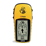
Garmin International Inc., a unit of Garmin Ltd. (NASDAQ:GRMN), recently announced they are going to launch a new and improved version of their best-selling eTrex handheld GPS device. Garmin’s eTrex is one of the most popular handheld GPS devices on the market.

The all-new eTrex GPS system will be redesigned and upgraded with new features – enhanced ergonomics, an improved interface, paperless geocaching and in certain models, a 65k color screen with expanded mapping capabilities.

The eTrex is an entry-level device that is designed especially for outdoor enthusists that enjoy activities such as hiking, biking and camping. The eTrex GPS system is very affordable, will fit in your pocket and is easy to use. It only has five buttons, making it easy to use with just one hand – the left hand, so lefties should be aware.

Ford’s New Smart Car Technology Means Less Accidents and Traffic

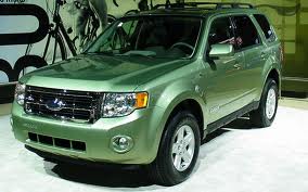
Ford Motor Company (NYSE: F) is a leader in bringing innovative safety and driver technology in mainstream vehicles. This week, Ford demonstrated how far they’ve come in car-to-car communication technology. Ford also showed what the future of driving may look like with talking vehicles that can warn of hazards and traffic ahead. Ford is one of the first automakers to build prototype vehicles demonstrating this exciting new technology.

With vehicle-to-vehicle communication, intelligent cars talk to each other wirelessly, warning drivers of potential dangers. Utilizing advanced wi-fi technology and GPS, intelligent vehicles will help drivers identify and respond to potential dangers as well as identify conveniences while on the road. With this technology cars will be able to send messages to other cars about where they are and where they’re headed.

If there is an accident or any other potential driving hazard coming up, vehicles will be able to instantly receive information about the upcoming dangers, giving drivers more notice and time to respond. The new technology is called a DVI system – which stands for Driver Vehicle Information. This technology provides either audible or visual cues to alert drivers of what potential dangers coming ahead.

Garmin Announces Launch of Rino Handheld Radio With GPS System

garmin rino gps system radioGarmin International Inc., a unit of Garmin Ltd. (NASDAQ:GRMN), the global leader in satellite navigation, just announced the redesigned and upgraded Rino 610, 650 and 655t. If you are a hunter, skier, hiker, or any other type of outdoor enthusiast – and like to venture out into the great unknown, then the all-new Garmin Rino handheld two-way radios integrated with GPS may be perfect for you.

If you put yourself in a potential survival situation, then you have to have a reliable communication device – no questions asked. You’ll also want to have the ability to quickly locate other persons in your party when traveling in a group, so they have a way to notify authorities and tell them where you are, in case of an emergency. If you ever saw the movie “127 Hours” starring James Franco, you’ll know exactly what I’m talking about.

If a friend also has a Rino then you can set it up so that you can see where the other person is via the GPS tracking system. An icon will flash showing the person’s name, location and any other information that they allowed to be public. This is extremely important when forming a network of fellow outdoor enthusiasts. You can also send unit-to-unit text messages to other Rino users in your area – it’s ideal for loud or windy conditions, or just when you don’t want to disturb the wildlife.

The Garmin GPS device also gives you the ability to store up to 1000 locations and save them onto the memory card. It also lets you save many waypoints, aka intermediary locations. For example, when hiking and you make a turn to start heading into another direction, you should record your waypoints. In case you decide you need to backtrack, the Garmin GPS system will take you right back to your last waypoints.

DHL Launches Green Fleet Vehicles in Manhattan

Last month DHL, one of the world’s largest logistics companies, launched a fleet of environmentally-friendly delivery trucks in Manhattan. Launching the new fleet of vehicles is an integral part of the DHL’s global Go Green strategy. DHL’s all-new Green Fleet is an important part of the company’s overall mission to reduce their environmental impact.

DHL’s goal is to improve the company’s carbon efficiency worldwide by 30 percent by 2020, compared to 2007 base levels. In addition to developing a greener fleet, the key components of DHL’s Go Green program includes the improvement of the energy efficiency in buildings, the implementation of innovative technologies, the mobilization of employees and the involvement of subcontractors and customers.

The company’s Green Fleet Initiative was launched in New York by Frank Appel, CEO of Deutsche Post DHL. According to Appel, “ Customers worldwide are increasingly demanding greener logistics, sustainable business procedures and initiatives like the one we are launching today will – at the same time – also enhance the profitability of our business. Sustainability, especially the reduction of carbon emissions, is a central aspect of our business and an integral part of our corporate strategy. As the global leader in logistics we are ideally positioned to foster climate protection in order to save our environment for future generations.”

Electric Vehicles Drive Green Fleet Growth By 2015

Managing a fleet used to be much more simple. Nobody bothered much about carbon emissions or the environment, or even fuel efficiency or leasing costs. It was all about status or, at best, about getting the job done, rather than any consideration for the environment.

Fast forward to 2011 and things have definitely changed. Environmental considerations are now at the top of the agenda for any corporate or government fleet manager. Creating a green fleet is not only good for the environment, but it is good fro the bottom line as well. Reducing fleet emissions typically means burning less fuel and running the most efficient fleet possible.

Traditionally hybrid electric vehicles have played an important role in creating a greener fleet. But more and more fleet managers are turning to plug-in electric vehicles (PEVs) as a solution. A recent report from Pike Research titled “Hybrid Electric Vehicles for Fleet Markets” forecasts that between 2010 and 2015, more than 1.3 million PEVs will be purchased for use in fleet operations, with nearly 400,000 vehicles being sold annually by the end of the forecast period.

achievement achievement achievement achievement achievement achievement achievement achievement