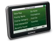
Garmin GPS System Navigation for Boating, Fishing and Flying

Garmin, the GPS system world leader, just released a very diverse group of GPS -based products at the 2011 CES Show in Las Vegas. Garmin has such a wide range of products, that they have a GPS system that works for just about anyone. If you enjoy sailing boating, fishing, flying and aviation related hobbies, here are a few Garmin GPS systems worth checking out:

Garmin just announced the release of the GHS 20 and GHS 20i full-function wireless remote handsets for Garmin’s VHF 200 and VHF 300 series radios, and the VHF 200i and VHF 300i international radios. With the GHS 20 or GHS 20i, your boat’s communication station doesn’t have to be stationary,” said Dan Bartel, Garmin’s vice president of worldwide sales. “The GHS 20/20i wireless handset is an invaluable accessory to mariners, as it gives them the freedom to move about the boat while always having full control of their VHF radio.”

4 Useful Things You May Not Know About Google Maps

1. See a “You Are Here” Location on a Map From Your Phone – Even Without GPS System

Have you ever noticed the dot between the four-point navigation tool and the zoom slider? t’s easy to miss! If you click that button while using Firefox or Google Chrome and, through the magic of the geolocation process, Google Maps for Mobile can tell you roughly where you are from your phone, even if you don’t have GPS tracking system. Google put together a video that explains how this works. It’s convenient when you’re in an unfamiliar place and don’t have the best sense of direction.

2. Find Places Near Any Point on a Map

If you’re searching for a certain place—a street name, a business, or other landmark—you can click on a marker and hit the “Search nearby” link to find coffee, gas, banks, or whatever else you need. What if you don’t have a place to pin down, but want to generally browse an area? Right click anywhere on a Google map, click “What’s Nearby?” in the box that pops up, and Google will create a pin based on a rough street address estimate, or with precise GPS tracking location coordinates. From there, you can click on “Search Nearby” in the box that appears in the left-hand pane, and search around without worrying about specifics.

Military Fleet Management Faces Tough, Unique Challenges

Fleet management is tough for anyone – but could you imagine operating a fleet of 300,000 trucks? The Army and Marine Corps have an inventory of over 300,000 trucks. Military vehicle fleet management is an incredibly tough challenge. They are trying to decide which fleet vehicles to keep, and how they will go about fixing or replacing damaged and outdated fleet vehicles.

Over the past several years the military has done a decent job of forecasting the quantities and types of fleet vehicles they will need. But fleet management forecasts with this size and type of fleet is never going to be perfect. Forecasts of future buys have been difficult due to internal disagreements over how to modernize the fleet of more than 150,000 Army and 25,000 Marine Corps Humvees. Because of their sheer numbers and the potential costs of acquiring new vehicles to replace old ones, Humvees are creating a challenging fix-or-buy-new dilemma for decision makers.

New GPS Navigation and Telematics Technology Exciting Part of CES 2011

CES is the world’s largest consumer electronics trade show held every year in Las Vegas in January. This year, recent advancements in vehicle, navigation and telematics technology made this area one of the most exciting parts of CES.

Here are highlights of the new technologies showcased at CES 2011:

Navigation
Garmin revealed a new version of its Nuvi navigation GPS system with an oversized screen, and TomTom displayed its Go 2505 GPS model with a new traffic service.

Boeing’s GPS Satellite Launch To Improve GPS System Accuracy

A Boeing Global Positioning System (GPS) IIF-1 satellite, built for the U.S. Air Force, is expected to be launched into orbit soon. Boeing is currently under Air Force contract to build 12 GPS IIF satellites. This will be the second satellite launched under the 12 GPS system satellite contract.

The GPS IIF satellites, with a design life of 12.7 years, will have improved anti-jam capability and substantially increased accuracy from earlier satellite versions. The GPS system signals are so accurate that time can be calculated to within a millionth of a second, velocity within a fraction of a mile per hour and location to within feet.

Garmin CEO Buys NYC Penthouse for $40 Million

Min Kao, the co-founder and CEO of Garmin, an industry leader in GPS system devices, just bought the 41st-floor condo at 15 Central Park West for $40 million from real estate developer William Lie Zeckendorf. The transaction is Manhattan’s second most expensive of the year, after the $44 million sale of the Duke Semans Mansion. The Journal reports that the final price actually comes out to $9,940 per square foot, not counting the enormous terrace.

Like many wealthy buyers, the CEO of corporate giant Garmin GPS purchased the apartment through a limited liability corporation, so until now his identity had not been disclosed. Mr. Kao was born and attended college in Taiwan. Over the past several years he has lived in the U.S. Forbes last year estimated his net worth at $1.6 billion, down from $4.7 billion in 2007, following a decline in Garmin stock.

New FMCSA Regulations Will Limit Driver Hours-of-Service

Fleet management take heed. Several trucking industry regulations have recently been proposed by the Federal Motor Carrier Safety Administration (FMCSA) and the National Highway Traffic Safety Administration. The proposed truck driver hours-of-service and speed limit regulations will have a huge impact on the trucking and transportation industry. The proposed rules are stirring up quite a heated controversy.

On Dec. 23, 2010 the Federal Motor Carrier Safety Administration (FMCSA) issued a regulatory proposal that would revise hours-of-service (HOS) requirements for commercial fleet truck drivers—requirements that have gone through multiple iterations and sparked numerous legal challenges since 2004. The rules are expected to be finalized by July 26, 2011.

Ski Resort GPS Tracking System Makes Snowboarding Safer and More Fun

GPS tracking systems are now being used by several ski and snowboard resorts worldwide for two primary reasons: more safety and more fun. Many families love going on ski/snowboard vacations together. But sending your young off children off to ski school by himself can be a bit disconcerting. What happens if your child gets lost or hurt on the mountain, how would you know? How would you be able to find him?

Well, don’t fret. The good news is that with a specialized GPS tracking system called Flaik, skiers and snowboarders can be located in real-time. If a skier needs to be located immediately, a resort employee can log into the system with an internet connected computer or phone. The web-based GPS tracking system can instantly display the child’s exact location.

CARB Awards Recognizes Leadership in Environmental Impact

The California Air Resources Board (CARB) is accepting nominations for its CoolCalifornia Small Business Awards, which recognize small California businesses (under 100 employees) that have shown leadership and taken action to reduce their energy bills and greenhouse gas emissions and made notable, voluntary achievements towards reducing their environmental impact. Nominations are being accepted until January 24, 2011.

Two categories of awards will be given — one recognizing the CoolCalifornia “Small Businesses of the Year” and another to the CoolCalifornia “Climate Leaders.”

The businesses of the year must demonstrate significant, measurable actions taken to reduce greenhouse gas emissions, save energy, invest in clean or renewable energy, purchase environmentally-conscious products such as hybrid or electric vehicles, and educate employees, customers and the general public. The “Climate Leaders” will be the most proactive nominees in reducing environmental impacts, through changes that may include efficient lighting, recycling programs, increased weatherization or the buying of environmentally-friendly products.

GPS Tracking Systems Help Drivers Arrive Safely During Tough Winter

GPS tracking systems are being used across the US to help drivers get through the tough winter months. This winter has been especially tough on many parts of the US, particularly the North West. Even cities such as Las Vegas, Atlanta and Austin are getting snow this winter.

When it snows a lot like it has been, most people wake up and want to know when the next snow plow will be coming through their neighborhood. Often times the information is difficult and/or time consuming to find, if it is even available at all. But now, thanks to a real-time fleet GPS tracking system and a city website, residents of Castle Rock, Colorado town are now able to stay abreast of snow plow progress throughout their community in real-time 24/7.

Vehicle GPS Tracking System in Dallas Garbage Trucks Pays Off

GPS tracking systems were installed in the City of Dallas’ garbage trucks at the end of 2009. At that point in time, some people were not convinced that the GPS tracking system would be worth the hefty price tag of $700,000. Several City Councilmembers voted against the deal over concerns echoed by the sanitation drivers union and a rejected GPS bidder. “There’s no proof that it’s going to work,” said union spokesperson Elisa Gonzalez. ”

But the majority of City administrators believed that by monitoring sanitation workers and improving the fleet management efforts of garbage trucks, they would be able to reduce overtime and increase overall efficiency and performance of waste removal teams. And turns out, they were right.

Dallas City Officials recently announced that the tracking system (in the first 12 months of use) has saved the city $677,000 – almost paying for itself. That means the GPS tracking system is saving the City of Dallas a little over $56,000 month. Now that is an amazing ROI!

GPS Tracking System Used to Recover Stolen Money From Bank

A GPS tracking system was used to recover a bag stuffed full of stolen hundred dollar bills from a recent bank robbery (Bank of America) in Buffalo, NY. The bag full of money was hidden inside a garbage can, but thanks to the GPS tracking system, police were able to quickly recover the money. The police will not disclose how the GPS tracking system got inside the bag full of money, but they did confirm that the GPS tracking system was placed inside the bag of money during the robbery by someone at the bank. Buffalo City Officials said that the GPS tracking device is so small or so well concealed that a robber might need to go through each bill or stack of bills to find it. How cool is that?

Gas Prices Predicted to Top $4 in 2011

Oil prices are expected to continue to rise in 2011 – beyond $100 a barrel. That could push gasoline prices to over $4 a gallon by summer in some parts of the country, according to industry experts. Not only will drivers feel the pain at the pump, but the cost of other goods and services will also rise. Whenever gas prices rise, the cost of doing business goes up. Many businesses whose margins are already razor thin are forced to pass the increased costs to the consumer. Things like food, travel, and retail goods become more expensive.

Gasoline price expert Fred Rozell predicted that 15 states, including Alaska, Hawaii, Connecticut and Rhode Island, will see gasoline prices top $4 a gallon by Memorial Day. “A dollar more per gallon …will cost about $750 more per year for each motorist, and there’s a psychological aspect to gas prices,” he said. “People are going to be up in arms about this.”

Gas Prices Expected to Remain High in 2011

Drivers across the US are cringing as they pull up to the gas pump. Drivers in many states are already paying at least $3 a gallon for regular and most analysts don’t predict any relief soon. That’s because crude oil has hovered between $83 and $89 a barrel since Thanksgiving, and the global demand for oil remains strong due to rapid growth in China and India.

Tom Kloza, publisher and chief oil analyst at OPIS, expects prices to fall during the winter and then begin to climb again. He has forecast prices between $3.25 and $3.75 a gallon from March to May, unless there is an unforeseen global economic issue. Pump prices could rise above $4 a gallon again in some states for the peak driving season, if oil prices continue to climb.

Inmates Released and Monitored with GPS Tracking System

GPS tracking technology lets officers monitor convicts without actually keeping them incarcerated. Providing housing, security, food, health care, plus administrative costs etc. to prisoners is an expensive financial burden for most states in the US. Due to the high costs, some states are using a GPS system to track nonviolent prisoners as an alternative to keeping them locked up.

This type of GPS tracking allows authorities to monitor the criminals at all times without the responsibility of keeping them incarcerated. While the GPS tracking system make it easier for states to track offenders, the use of such systems does have its downsides.

Used Cooking Oil Helps Vehicle Fleets Reduce Emissions

New Leaf Biofuel is a San Diego based biodiesel company focused on transforming the way companies fuel their vehicle fleets. New Leaf BioFuel collects used cooking oil from roughly 1,000 local restaurants and converts it to biodiesel fuel. It sells the biodiesel to distributors who sell the fuel to customers running green fleets of diesel trucks.

Vehicles run cleaner and quieter on biodiesel and the fleet emissions are much better. Biodiesel is an alternative renewable fuel made from plant and animal oils that is used in diesel engines. It has been shown to reduce vehicle emissions by 75% on average compared to petroleum diesel.

Fleet GPS Tracking Helps Keep Roads Clear and Safe This Winter

There has been record snow fall in many parts of the US this winter. Right now in California, there is record rainfall which means accidents, landslides, flooding, etc. Driving in winter can be quite a challenge. Harsh winter driving conditions are especially challenging for those responsible for keeping the roads clear and safe. Municipalities and snow removal companies are working long and hard to clear away the water, ice and white blankets of snow that inevitably slow down drivers during the busy holiday season.

The equipment and vehicles used to remove snow are now equipped with GPS fleet tracking devices. With the help of the fleet tracking system, the roads can be cleared much quicker. The GPS tracking can show the exact location of the road cleaning equipment in real-time. The system can monitor the position of the equipment from anywhere with an internet connection, allowing managers to visually dispatch their fleet without having to be on site.

Google Maps Now Gives Users 3-D Interactive GPS System

Google Maps has just released two great new features for the Android – GPS System 3D interaction, offline reliability.

Offline Reliability

Mobile Internet connections are never 100% reliable but this is a huge step toward greater offline reliability. These new updates provide a solution to one of the biggest limitations with a mobile GPS system – being able to access and use your navigation GPS system while you are offline, so you can find your way even if you lose your connection. Most GPS system users have all had those frustrating moments when you get stranded without a map – like when you’re driving in the mountains and the cel coverage is limited or anywhere else with an unreliable Internet connection.

According to Google’s blog post, “dynamically drawing maps requires 100 times less data to get maps across all zoom levels, so now we’re able to proactively cache (or store) large areas on your device based on where you use Maps the most. This way, you can rely on having fast, robust maps available to you where you’re most likely to need them.”

achievement achievement achievement achievement achievement achievement achievement achievement