Track Bus, Train and Ship Locations with new GPS System

Ever been stuck waiting for a bus, train or ferry and wondered, “Where the heck is my ride? Well, thanks to modern GPS technology, this issue may become a thing of the past. New GPS tracking systems are being installed across the country so people can monitor the whereabouts of their public transportation in real-time.

This type of tracking system is especially helpful to people when the weather conditions are severe. No one likes standing in the rain, snow or extreme heat waiting for a ride. Now when a bus or train is late, you can take shelter from the heat or cold because you will know exactly when your ride will be arriving.

In Michigan, people on-the-go who use a smart phone or another hand-held device that can access the Internet will be able to track the location of their city bus fleet in real-time using GPS tracking technology. Passengers will be able to tell when the bus will get to their stop.

Never Lose Your Pet With Qualcomm’s New Tagg Tracking System

Hundreds of thousands of pets go missing every year, and according to the National Council on Pet Population Study and Policy, only 15 to 20 percent of lost dogs and only two percent of lost cats are ever returned to their owners. Pet owners can now put their minds at ease as they no longer have to worry about their dog or cats getting lost, thanks to Tagg—The Pet Tracker.

Tagg is a GPS-enabled, wireless pet tracking system that enables pet parents to monitor their animals’ location. Tagg provides peace of mind for any pet parent by providing them access to their pet’s whereabouts via a mobile phone, mobile device or computer.

The Tagg pet tracking system uses advanced GPS technology to enable pet owners to know where their pets are and be notified if they wander off. Tagg uses a sophisticated combination of GPS and wireless technology to monitor a pet’s location and quickly notify the owner via email and/or text if the pet leaves its Tagg zone, the area where it spends most of its time—typically the home, yard and adjacent areas.

How To Stop GPS Data in Photos From Revealing Where You Live

Did you know that a lot of smart phones encode the location of where pictures are taken? Anyone who has a copy can access this information. If you or someone yu know snaps a photo of you and then uploads it to the internet on social media sites such as Facebook or Twitter, it is very easy to figure out exactly where the picture was taken.

Browser plug-ins and certain software programs can reveal the geotag location information of your photos and movies to anyone who wants to see it. Location information (GPS coordinates) stored inside photos can reveal your home address, work address, places you visit often, etc. Geotags can make it very easy for people – friends, family, bosses, spouses, parents – to know exactly where you are.

While this may be disconcerting (especially for parents of teenagers!) the good news is disabling geo-tagging on your phone is easy.

Facebook Users Beware: GPS Data in Photos Can Reveal Where You Live

Twitter is the social-media platform that lets users communicate in short posts called tweets. It is very common for Twitter users to snap pictures using their mobile phone and to instantly upload them to Twitter. But users should beware, because you may be sharing more than just a photo. You may actually be revealing where you live, work and play.

Ever snapped a photo with your phone, then uploaded it to post on Twitter? You may have shared more than just an image. ICanStalkU.com was set up by tech consultants to alert Twitter users that their smartphone pics are embedded with GPS data, making it so easy to determine your precise latitude and longitude that “a first grader could stalk someone,” says cofounder Larry Pesce. For its part, Twitter’s image-hosting service strips geotagged data from phone-uploaded pics, but third-party services like TwitPic are still vulnerable. Twitter has twice suspended ICanStalkU’s account, calling the site’s cautionary tweets spam. But Pesce says, “If we thought of it, someone else much more evil and smarter has been using it.”
Did you know that GPS location data can be recorded when someone takes a picture of you?

According to the New York Times, when Adam Savage, host of the popular science program “MythBusters,” posted a picture on Twitter of his car parked in front of his house, he let his fans know much more than that he drove a Toyota Land Cruiser. Embedded in the image was a geotag, a bit of GPS data providing the longitude and latitude of where the photo was taken. Hence, he revealed exactly where he lived. And since the accompanying text was “Now it’s off to work,” potential thieves knew he would not be at home.

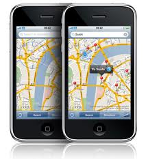
Geotagging is when a device such as an iPhone, Android smartphone or digital camera stores your location or geographical information, such as your GPS coordinates, within a photo or movie file (such as .jpg or .mov files). The tricky thing about geo-tags is that they are invisible to the naked eye. Geo-tags are part of the meta-data, or underlying data about the data, that accompanies each file. The problem occurs when you or someone you may know are geo-tagging your photos and then uploading them to the internet – especially social media sites like Twitter. When social media users take a picture or video and upload it to their page, they are probably transmitting far more data than they think.

Garmin Launches New Turn-By-Turn GPS Navigation App for iPhone

Garmin just released a new GPS navigation App for the iPhone called Garmin StreetPilot. Garmin StreetPilot App gives iPhone users an intuitive Garmin interface for everyday navigation– without tapping into your dataplan. The Garmin StreetPilot App offers mapping, free real time speed camera alerts, traffic avoidance options and a host of other options for efficient routing, simple effortless planning and stress-free travel whether driving or on foot.

The Garmin Street Pilot App has advanced navigation features such as Garmin’s exclusive PhotoReal junction view , lane guidance, 3D buildings, trip planner, trip computer, Garmin’s “Where Am I?” safety feature and free real-time speed camera information including the location of temporary mobile cameras, based on real-time feedback from the ‘Speedwatch’ community.

With ultra-fast map drawing, panning and zooming, the preloaded maps and Points of Interest offer coverage even when there is little or no mobile signal available. So just as with a Garmin Nüvi, the maps and directions are always there when you need them most – especially when you can’t get cell or Wi-Fi signals or your dataplan is running low.

FieldLogix Helps Dunphy’s ExtermaPest Cut Fuel Bill by $700/Mo

Dunphy’s ExtermaPest Cuts Gas Costs by $700 a Month For a 10 Vehicle Fleet With FieldLogix Fleet Tracking System

With today’s high fuel costs and a sluggish economy, companies are seeking ways to reduce their operating costs. One way to reduce costs dramatically is through the use of a GPS fleet tracking system.

Ron Dunphy, president of Dunphy’s Extermapest in Palm Springs, California has seen a significant reduction in fuel costs since implementing FieldLogix.

Dunphy said, “Before implementing FieldLogix last year, when gas prices were much lower, I was spending $3,400 a month on fuel for my 10 vehicles. After installing FieldLogix on my vehicles, I now spend $2,700 per month on fuel, even with higher gas prices!”

FCC to Protect GPS System From LightSquared Interference

LightSquared is currently seeking approval from the FCC to move forward with its plans to build out a broadband wireless network. But the company has been facing fierce opposition from dozens of companies and organizations claiming the proposed network will interfere with GPS system signals.

Construction of LightSquared’s new wireless network is currently on hold as federal regulators wait to make sure the network will not cause interference with GPS system receivers. However, the FCC could not provide a timetable as to when continued testing, design modification, and review of the project would be complete.

In an effort to resolve the issue and make a decision , this week the FCC sent letters to both LightSquared and key members of the GPS industry. Letters were sent to LightSquared’s engineering and technology chief Julius Knapp, and GPS industry members such as Garmin (NASDAQ: GRMN), and the Federal Aviation Administration (FAA). The FCC asked both parties to spell out exactly which GPS devices see interference and how those devices will interact with LightSquared’s newly scaled-down deployment plan.

Solar Storms May Disrupt GPS System Signals This Week

Over the weekend there were three large magnetic explosions from the sun, prompting U.S. government scientists to caution users of satellite, telecommunications and electric equipment to prepare for possible disruptions over the next few days. As you read this, we are at the peak of the 11-year solar cycle. So drivers should double-check their GPS system, and watch where they’re going.

Solar storms this week could affect communications and global positioning system (GPS system) satellites and might even produce an aurora visible as far south as Minnesota and Wisconsin. Usually the aurora borealis, called the northern lights, are limited to northern latitudes, but the energy of this storm’s colliding energized particles may broaden the display.

GM Launches New Vehicle Tracking System to Monitor Teens While Driving

General Motors is testing a new tracking system in the US. The tracking system can be used to locate a stolen vehicle, and it can also keep track of family members behind the wheel.

The vehicle tracking system is called Family Link. For parents of inexperienced teen drivers, using Family Link can help to give parents peace of mind because they will be able to monitor their child’s location and know they are safe. The service enables users to log onto a website at any time of the day to find their vehicle’s location.

The Family Link tracking system can send text or email alerts set for specific times. OnStar is planning to expand this to include alerts when a driver arrives at a destination, if a predetermined speed limit is broken or when a navigation boundary is crossed.

In order to use the system you must have a vehicle equipped with On-Star and subscribe to the On-Star service. Even if you don’t drive a GM, any vehicle can use the OnStar system and service by purchasing an aftermarket rear-view mirror equipped with the OnStar telematics-based communication system.

Sunshine Landscape Gets an ROI in 18 Days with FieldLogix

Sunshine Landscape Sees Positive Return on Investment in 18 Days with FieldLogix GPS Fleet Tracking System

Carlos Contreras, at Sunshine Landscape in Palm Desert, CA, manages 15 employees who had been using paper timesheets for years. Carlos always suspected that the timesheets weren’t completely accurate.

Carlos then decided that GPS fleet tracking would help him address these concerns and give him more control over his mobile employees. Carlos selected FieldLogix due to its user-friendly interface, affordable hardware, and extensive e-mail alert features.

Upon installing FieldLogix fleet tracking system, Carlos’ suspicions were immediately confirmed. By using the system’s activity reports, he found that his “honor system” was being abused by his employees. By having an accurate way to measure daily work hours, his overtime costs dropped immediately.

Fleet Tracking System Features to Consider, Part One

Fleet Tracking System Features – Part One

If your business requires vehicles and mobile employees, and you are interested in finding ways to increase your company’s productivity and profitability, then you should consider investing in a GPS Fleet Tracking System.

A Fleet Tracking System can provide your company with numerous benefits at an affordable price. A fleet tracking system can help the average fleet reduce fuel costs by up to 20%. Most customers typically see a positive ROI in less than 6 months.

There are several factors to consider when researching and selecting the right Fleet Tracking System. Here are some of the fleet tracking features you should be considering in your purchase decision.

GPS-Equipped Toucans Help Scientists Monitor Seed Dispersal

GPS Tracking Devices Attached to Toucans Help Scientists Gather Data on Seed Dispersal

There were two main things scientists had to do to set up the experiment, which took place in Panama. First, the scientists had to figure out how long and how many seeds the Toucans would eat in a day. So the scientists gathered fresh seeds from a nutmeg tree and fed them to captive toucans at the Rotterdam Zoo.

Toucans love nutmeg seeds. When Toucans eat, they gulp the nutmeg seeds whole. The outer pulp is processed in the bird’s crop, and the hard inner seed is then regurgitated.

During the GPS tracking experiment, five zoo toucans fed 100 nutmeg seeds took an average of 25.5 minutes to process and regurgitate the seeds.

Next the scientists captured six wild toucans that were feeding from a large nutmeg tree in the rainforest. The scientists attached lightweight backpacks containing GPS tracking devices to the wild birds.The GPS tracking devices recorded the birds’ exact location every 15 minutes and used accelerometers to measure the Toucans’ daily activity level.

New Satellite Technology Allows Planes To Fly Over Polar Regions

A new satellite communication for oceanic flights has been approved by the U.S. Federal Aviation Administration (FAA). Now airlines can use the satellite communication to fly through the Polar Regions instead of around them, while still maintaining communication with air traffic control.

Until now, airlines had no way of communicating in the Polar Region besides using a High Frequency (HF) radio, which is so unreliable that airlines decided not to use it because it was too dangerous. Now, being able to fly over the poles, airlines can save time and money. Plus they will produce less pollution.

According to Damien McCormack, director of Aircraft Solutions at SITA, flying over the poles can save approximately 30 minutes to an hour in flight time, depending on the size of the aircraft, flight route and exactly what points over the Poles the plane is flying.

McCormack also said that by saving one hour on an airbus 330, which can accommodate up to 335 passengers, it can account to a savings of 5.5 tons of fuel, which equates to 17 tons of C02 emissions. With a Boeing 747, which can accommodate between 416-524 passengers, saving one hour of flying time would account to saving 10 tons of fuel, which equates to 35 tons of C02 emissions.

Survey Finds GPS Tracking Lowers Vehicle Operating Costs

A new vehicle tracking survey was released last month in the UK. Results of the study showed that businesses using fleet GPS tracking systems are saving money in several ways. The vehicle tracking survey showed that businesses can achieve measurable benefits in terms of fleet performance, service and legislative compliance.

The vehicle tracking study was conducted by CTrack. The company surveyed over 250 fleet decision makers in the UK. The survey was developed to provide insight into the uptake of vehicle tracking amongst UK-based businesses, how the technology is being used, what benefits are being achieved and what barriers are preventing more companies adopting a vehicle tracking solution. When asked about the primary purpose for vehicle tracking more than a third of the respondents using the technology stated productivity was the main reason, whilst cost reduction, asset management and customer service made up almost half of the answers.

GPS Tracking System Busts County Employees at Golf Course

Earlier this year in Muskegon Cunty, Michigan, rumors were spreading that city employees were not working when and where they said they were. A county judge, John Ruck, became suspect after hearing rumors that a handful of city employees were misusing city vehicles and decided to take action.

He rallied enough support and money from the county and the state to purchase several vehicle tracking systems. Ruck then ordered someone to install the tracking systems inconspicuously in the trunk of several county owned fleet vehicles. The GPS tracking systems started gathering information in June.

Court administrators reviewed the vehicle tracking system data for several weeks looking for discrepancies. According to Ruck the process was simple – look at the employee’s time card and where the car they checked out was located.

Then lo and behold, the GPS tracking system data revealed that three county workers were not working while on the clock. One spent several hours at a golf course, another at the gym. Both resigned when confronted about the abuse. A third employee, whose error was not as egregious, is going to be disciplined.

Habitat for Humanity Selects FieldLogix to Improve Customer Service

Habitat for Humanity Selects FieldLogix Fleet GPS to Improve Customer Service and Reduce Fuel Usage

Habitat for Humanity Charlotte announced last month that it has installed FieldLogix Fleet GPS Tracking Systems in its entire fleet of vehicles. Since deploying a fleet GPS tracking system, Habitat for Humanity has reported an improvement in customer response times, the amount of job orders completed, and reduced fuel consumption.

Improved Customer Service

Now Habitat for Humanity dispatchers can keep a close eye on the exact location of every vehicle in its fleet in real-time. According to Habitat For Humanity manager, Jon Huffman, “We can make last minutes changes with just a few clicks. If drivers are running late, we can call ahead of time to let someone know. FieldLogix gives dispatchers the ability to assign jobs in a way that maximizes productivity and service, since vehicle stops are constantly being added or changed throughout the day.”

Reduced Fuel Consumption

Jon Huffman also added, “We have experienced significant savings in fuel expenses since installing FieldLogix. We are quite pleased with that. The initial improvements have been so good that we haven’t had time to see everything else the system can do for us!”

Eco-Friendly Driving

Huffman further stated, “FieldLogix is a Green company with an eco-friendly product. It was important for us to choose a company with same core values as Habitat for Humanity.”

Leaked FAA Report Says LightSquared Network Will Kill 794 People

A report about the effects of LightSquared’s proposed network was supposedly leaked from the Federal Aviation Administration (FAA) this week, according to a report from PC Mag. The effects of LightSquared deployment would be far-reaching and potentially devastating to aviation.

The “estimated loss of life from 2014 to 2023 as a result of LightSquared impacts to GPS during a period when the nation’s aircraft were retrofitted to accommodate the LightSquared signals would include 794 deaths, with a value of life totaling $4.9 billion,” the report states.

The FAA’s Navigation Services division also said there will be over $72 billion in additional costs to U.S. taxpayers if the LightSquared LTE system is implemented. The FAA report called that estimates conservative, and it did not include injuries or property loss.

The FAA’s report, dated Jul 12, said the LightSquared network would interfere with the GPS systems that US aviation depends on everyday. The Federal Aviation Administration says even a revised proposal from LightSquared to launch a national wireless broadband network will interfere with global positioning systems critical to aviation.

“Proposed LightSquared operations would severely impact the efficiency and modernization of the safest, most efficient aerospace system in the world. After the LightSquared network is deployed, GPS systems are expected to be unavailable for planned aviation use over the whole of the continental U.S. based upon FAA analysis and tests, ” the report concludes.

US Drivers Waste $155 Billion Dollars A Year Idling in Traffic

When a vehicle is left idling, it can consume one gallon of gas each hour. “Traffic congestion costs the U.S. economy upwards of $155 billion dollars annually,” said Kleiner Perkins partner Michael Linse in a statement. “Last year alone, U.S. drivers wasted 3.9 billion gallons of fuel sitting idle in traffic, and the U.S. is a small part of a much larger and growing global traffic problem.”

No one likes wasting time and money sitting in traffic. Sometimes it is unavoidable, but sometimes it isn’t. With today’s high cost of fuel and the growing awareness of our need to protect our planet, the amount of idling vehicles must be reduced. Drivers can and should be doing something.

A GPS navigation system with real-time traffic updates such as FieldLogix can absolutely help to reduce the time and money drivers waste sitting in traffic. Reducing idling time by only 15 minutes a day can reduce fuel use by over $84 per year. If you reduce idling time by 60 minutes a day, it would result in a fuel savings of 90 gallons at a cost of over $339 per year.

Take the tour

  • Watch short videos to see how we can improve your fleet's operations.

  • This field is hidden when viewing the form
  • We will only send you an invite and will not SPAM you or share your info with 3rd parties

  • This field is hidden when viewing the form
  • This field is hidden when viewing the form
  • This field is hidden when viewing the form
  • This field is hidden when viewing the form
  • This field is hidden when viewing the form
  • This field is hidden when viewing the form
  • This field is hidden when viewing the form
  • This field is hidden when viewing the form
  • This field is hidden when viewing the form
  • This field is hidden when viewing the form
  • This field is hidden when viewing the form
  • This field is hidden when viewing the form
  • This field is hidden when viewing the form
  • This field is hidden when viewing the form
achievementachievementachievementachievementachievementachievement