Questions?
(888) 803-0200
learnmore@fieldlogix.com
We WILL NOT sell or share your info with anyone.
In Mexico many families are constantly living under the threat of being kidnapped. It is a scary but true reality. Kidnappings are up 317 percent in the past five years, according to a recent Mexican congressional report.
Wealthy and upper class Mexicans living in fear of being kidnapped are turning to GPS tracking devices as a precautionary measure. People are spending thousands of dollars to have GPS tracking-enabled RFID chips implanted under their skin and the skin of family members.
However, scientists are claiming the tracking devices don’t work, according to The Washington Post.
The chip, implanted in the tissue between the shoulder and elbow, sends a signal to a GPS tracking device that the wearer carries. The chip relays a signal to an external Global Positioning System unit the size of a cellphone, but if the owner is stripped of the GPS device in the event of an abduction, Xega can still track down its clients by sending radio signals to the implant. The company says it has helped rescue 178 clients in the past decade
According to the Post, this claim seems very unlikely to be true.
The FBI says a robbery suspect managed to get away with cash from a suburban Chicago bank, but he also got something he hadn’t bargained for — a GPS tracking system. The robbery suspect was arrested after police monitored his movements through a GPS tracking system hidden with cash he stole from a bank, according to officials.
After a man walked into a local Chicago Bank of America branch, he spoke with a bank teller and then handed the bank employee a note that said he wanted her to hand over a bag of cash. Not wanting to escalate the situation, the bank teller placed a bunch of cash into a bag and handed the money to the bank robber. However, the quick-thinking bank teller also placed a GPS tracking system in the bag, allowing police to follow the cash in real-time.
The fight between LightSquared and the GPS industry is heating up again. LightSquared is accusing the GPS industry of failing to follow US Department of Defense (DoD) GPS filtering standards, and the GPS industry saying in return that LightSquared clearly doesn’t understand the technology it is trying to sell.
LightSquared is proposing to create a nationwide satellite-based voice and Internet data service. It received conditional approval to do so from the FCC in January as long as the company could show that its operations wouldn’t interfere with existing GPS systems, a fear expressed by GPS device manufacturers and users alike. Tests completed this spring demonstrated that GPS systems would indeed be interfered with by LightSquared proposed operations. LightSquared said in June not to worry, though, since it had developed a technical solution to the interference problem.
LightSquared asked the FCC why it needs to change its operations when the GPS interference problem clearly resides with an irresponsible GPS industry that is only interested in “squatting for free on someone else’s licensed spectrum.”
Stop Wasting Money on Excess Idling With FieldLogix Fleet GPS
Did you know that each year fleet vehicles burn 8.9 billion gallons of fuel annually due to unnecessary idling and speeding? Chances are each of your vehicles burns up to 800 gallons of fuel per year due to unnecessary idling alone, which costs an estimated $2,864 per vehicle annually based on current gas prices of $3.58 a gallon.
Excessive idling is a tried and true fuel waster and is extraordinarily common in truck fleets, where frequent stops and starts are common.
The FieldLogix Customized Green Report identifies which vehicles are wasting time and money on excessive idling and speeding. The Excessive Fuel Report calculates how much money this is costing and shows how much CO2 is being emitted due to these avoidable driving habits. The green reporting features give each vehicle a Green Score and ranks each driver by who is most efficient.
FieldLogix Fleet GPS can you exactly how long a vehicle or group of vehicles has been idling – in real time or via minute-by-minute reports. You can see online where a vehicle was parked at each idling session, overlaid on familiar Google Maps. When enabled, idle alerts can be requested over the next 10, 20, 30, 40, 50 or 60 minutes, or set to alert you every 10 minutes via cell phone text message or email.
Gas prices have dropped for two consecutive weeks in the US, and further decreases are expected in September. A gallon of regular unleaded gas is currently averaging $3.58, compared to $3.68 one month ago. At this rate, could prices drop below $3.50 by the end of September, after the end of the peak summer driving season.
Several analysts and experts expect that gas prices will move down very sharply after nearing close to $4 earlier in the year. The Wall Street Journal reports that lower oil prices may trigger this. “Somewhere along the line, there will be a 10- to 15-cent drop in gasoline prices,” said Kyle Cooper, managing partner of IAF Energy Advisors in Houston. “You have to expect that those prices start to trickle down.”
Ever been stuck waiting for a bus, train or ferry and wondered, “Where the heck is my ride? Well, thanks to modern GPS technology, this issue may become a thing of the past. New GPS tracking systems are being installed across the country so people can monitor the whereabouts of their public transportation in real-time.
This type of tracking system is especially helpful to people when the weather conditions are severe. No one likes standing in the rain, snow or extreme heat waiting for a ride. Now when a bus or train is late, you can take shelter from the heat or cold because you will know exactly when your ride will be arriving.
In Michigan, people on-the-go who use a smart phone or another hand-held device that can access the Internet will be able to track the location of their city bus fleet in real-time using GPS tracking technology. Passengers will be able to tell when the bus will get to their stop.
Gas prices fell last week as consumer confidence reached a 30-year low, pushing oil prices down. On Monday, at the end of trading on the NYMEX, crude oil settled at $87.88 per barrel, up $2.50.
While crude oil prices have exhibited dramatic shifts in momentum in recent trading, gasoline prices have continued to steadily decline. The current national retail average price for a gallon of self-serve regular gasoline is $3.59. Today’s average price is seven cents cheaper than one week ago and eight cents cheaper than one month ago, but remains 83 cents higher than one year ago according to the AAA Fuel Gauge Report.
After rising for 25 of 31 days in July, the national average price at the pump has fallen for 14 of 15 days to begin August. As of today, Hawaii ($4.11) is the only state that remains above the $4 per gallon threshold.
School boards are under pressure to not only provide a safe, reliable transportation service to school children and their parents, but also to run as efficiently as possible in light of today’s budget restraints. A GPS tracking system can make a school bus fleet more profitable, plus it helps to keep children safe.
Which is why last week in Prince County, Maryland, a local school board voted and approved to upgrade the school system’s fleet of buses with new GPS tracking systems.
The new GPS tracking system will provide several benefits to the school bus fleet. In addition to being able to guide drivers who have gotten lost, the system will be able to track if a bus is speeding and send e-mail updates. Previously, the only way to know would be to do radar checks or rely on complaints. The system can also monitor bus driving patterns to make sure drivers operate their vehicles efficiently, eliminating unnecessary idling, observing speed limits and not taking detours.
Hundreds of thousands of pets go missing every year, and according to the National Council on Pet Population Study and Policy, only 15 to 20 percent of lost dogs and only two percent of lost cats are ever returned to their owners. Pet owners can now put their minds at ease as they no longer have to worry about their dog or cats getting lost, thanks to Tagg—The Pet Tracker.
Tagg is a GPS-enabled, wireless pet tracking system that enables pet parents to monitor their animals’ location. Tagg provides peace of mind for any pet parent by providing them access to their pet’s whereabouts via a mobile phone, mobile device or computer.
The Tagg pet tracking system uses advanced GPS technology to enable pet owners to know where their pets are and be notified if they wander off. Tagg uses a sophisticated combination of GPS and wireless technology to monitor a pet’s location and quickly notify the owner via email and/or text if the pet leaves its Tagg zone, the area where it spends most of its time—typically the home, yard and adjacent areas.
Did you know that a lot of smart phones encode the location of where pictures are taken? Anyone who has a copy can access this information. If you or someone yu know snaps a photo of you and then uploads it to the internet on social media sites such as Facebook or Twitter, it is very easy to figure out exactly where the picture was taken.
Browser plug-ins and certain software programs can reveal the geotag location information of your photos and movies to anyone who wants to see it. Location information (GPS coordinates) stored inside photos can reveal your home address, work address, places you visit often, etc. Geotags can make it very easy for people – friends, family, bosses, spouses, parents – to know exactly where you are.
While this may be disconcerting (especially for parents of teenagers!) the good news is disabling geo-tagging on your phone is easy.
Twitter is the social-media platform that lets users communicate in short posts called tweets. It is very common for Twitter users to snap pictures using their mobile phone and to instantly upload them to Twitter. But users should beware, because you may be sharing more than just a photo. You may actually be revealing where you live, work and play.
Ever snapped a photo with your phone, then uploaded it to post on Twitter? You may have shared more than just an image. ICanStalkU.com was set up by tech consultants to alert Twitter users that their smartphone pics are embedded with GPS data, making it so easy to determine your precise latitude and longitude that “a first grader could stalk someone,” says cofounder Larry Pesce. For its part, Twitter’s image-hosting service strips geotagged data from phone-uploaded pics, but third-party services like TwitPic are still vulnerable. Twitter has twice suspended ICanStalkU’s account, calling the site’s cautionary tweets spam. But Pesce says, “If we thought of it, someone else much more evil and smarter has been using it.”
Did you know that GPS location data can be recorded when someone takes a picture of you?
According to the New York Times, when Adam Savage, host of the popular science program “MythBusters,” posted a picture on Twitter of his car parked in front of his house, he let his fans know much more than that he drove a Toyota Land Cruiser. Embedded in the image was a geotag, a bit of GPS data providing the longitude and latitude of where the photo was taken. Hence, he revealed exactly where he lived. And since the accompanying text was “Now it’s off to work,” potential thieves knew he would not be at home.
Geotagging is when a device such as an iPhone, Android smartphone or digital camera stores your location or geographical information, such as your GPS coordinates, within a photo or movie file (such as .jpg or .mov files). The tricky thing about geo-tags is that they are invisible to the naked eye. Geo-tags are part of the meta-data, or underlying data about the data, that accompanies each file. The problem occurs when you or someone you may know are geo-tagging your photos and then uploading them to the internet – especially social media sites like Twitter. When social media users take a picture or video and upload it to their page, they are probably transmitting far more data than they think.
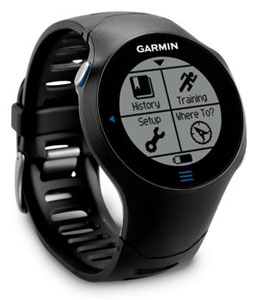
Garmin just released a new GPS navigation App for the iPhone called Garmin StreetPilot. Garmin StreetPilot App gives iPhone users an intuitive Garmin interface for everyday navigation– without tapping into your dataplan. The Garmin StreetPilot App offers mapping, free real time speed camera alerts, traffic avoidance options and a host of other options for efficient routing, simple effortless planning and stress-free travel whether driving or on foot.
The Garmin Street Pilot App has advanced navigation features such as Garmin’s exclusive PhotoReal junction view , lane guidance, 3D buildings, trip planner, trip computer, Garmin’s “Where Am I?” safety feature and free real-time speed camera information including the location of temporary mobile cameras, based on real-time feedback from the ‘Speedwatch’ community.
With ultra-fast map drawing, panning and zooming, the preloaded maps and Points of Interest offer coverage even when there is little or no mobile signal available. So just as with a Garmin Nüvi, the maps and directions are always there when you need them most – especially when you can’t get cell or Wi-Fi signals or your dataplan is running low.